Backtracking along the valley floor, we drove up Wawona Road to Tunnel View, one of the most famous viewpoints in the valley. El Capitan dominated the left hand side while the Cathedral Rocks and Bridalveil Falls filled the foreground on the right. Glacier Point and Half Dome were visible in the distance. It was crowded at the viewpoint, but we found a peaceful spot just a short walk up the Pohono Trail on a nearby granite slope. Leaving Tunnel View behind, we drove the entire length of the valley to get a feel for the area we would be visiting for three more days. Parking near Half Dome Village, (previously Curry Village), we saw a doe and her two spotted fawns feeding in Stoneman Meadow during sunset.
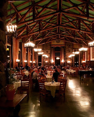
For our first night in Yosemite, we enjoyed a wonderful dinner under the 34-foot high ceilings of the dining room at the historic Ahwahnee Hotel. (Now called the Majestic Yosemite Hotel due to a legal battle over the hotel name being trademarked by the former concessionaire.) Built in 1927, the 97 room hotel was designed to feel like a luxurious country home and men used to be required to wear a jacket for dinner but I only needed a collared shirt while Tori had to wear either a dress or pants with a blouse. I ordered the special, a huge pork chop, and Tori ordered the fish. For desert, we shared the toffee cake for two. I had read many reviews complaining about the food and service but all our dishes were delicious and our server was very attentive.
Sunday morning, Tori and I rented bikes at Yosemite Lodge and rode the circular trail around the valley floor. Our route started at Leidig Meadow beneath the Three Brothers. After crossing the Swinging Bridge over Merced River we pedaled east along Southside Drive until we stopped at the LeConte Memorial Lodge across the road from Housekeeping Camp. Built in 1903, the granite building was the Sierra Club's original summer headquarters and served as the park's first visitor center. Passing Half Dome Village and the Happy Isles Nature Center, we took the side road up Tenaya Canyon to dry Mirror Lake which is directly under Half Dome. In the shadows, the sheer North Face looked forbidding overhead. As we rode back west along the bike trail we had a close-up view of the Washington Column and the Royal Arches through the trees.
Back at the Yosemite Lodge, we boarded the bus for the 1:30pm Glacier Point Tour. Since we were going to hike back down from Glacier Point, we only needed one-way tickets. Our guide had a lot of good stories as she wound the bus up the long winding road to the top. After unloaded our gear, our first amazing view near the amphitheater was of the back-country behind Half Dome. The Vernal and Nevada Falls, visible in the foreground, were still flowing, but low. We hoped the visible rain falling in the high country behind would pump them up a bit before we hiked the Mist Trail on Tuesday. Climbing the short path to the main viewpoint, we were able to stand right at the edge of the railing overlooking the sheer drop down to the valley floor below. I can't believe people who can climb over the railing to stand out on Overhanging Rock for a photo. I had the heebie-geebies just thinking about it.
The rain clouds threatening overhead began to disperse as we started hiking westward down 4 Mile Trail to the valley floor. In the early 1900s, the trail was lengthened to 4.8 miles along the steep cliffs. The first section was fairly straight and descended slowly along the ridge looking back toward Glacier Point and Half Dome. If you have a fear of heights, there are several spots with exposed windows looking straight down to the valley floor. Before the trail descends two long sections of switchbacks, it reveals a reverse tunnel view of the valley towards El Capitan. About a third of the way down, we took the short spur leading out to Union Point. In the winter, only the trail below this point is open.
The sharp switchbacks of the 4 Mile Trail are directly across the valley from the Yosemite Falls. I wish they weren't dry at this time of year but it was interesting to see how the falls have stained the cliff face. Despite my walking sticks, my bad knee started to ache near the bottom of the switchbacks so we stopped for a snack break. (Delicious Turkey Sandwiches and Pretzels.) The bottom quarter of the trail traveled under the base of the towering Sentinel Rock before ending at the trailhead near Swinging Bridge. Next time we hike this trail, I want to do it in the Spring when the falls are roaring across the valley in full flow.
Monday morning, we left Yosemite Valley behind and explored the other areas of the park along the Tioga Road. Our first stop was Tuolumne Grove, one of three groves of Giant Sequoias within Yosemite. A mile hike down a ravine along the Old Big Oak Flat Road, we encountered our first sequoia, Big Red. While only average-sized compared to many we saw later in Sequoia National Park, it looked giant enough to our virgin eyes. Further along the trail was the Tunnel Tree with a stagecoach-sized tunnel carved through the old sequoia stump in 1878 to attract visitors to the former toll road into the park. Among the two dozen mature sequoias of this small grove also lies the Fallen Giant, a massive log hollowed out by fire. Tori looked tiny when she climbed on top and stood next to the exposed roots.
About halfway between Crane Flat and White Wolf, we parked to investigate a granite dome on the side of the Tioga Road. Our legs were very sore from hiking the 4 Mile Trail on Sunday and it was nice to stretch our legs and climb up the gently sloping granite dome that was formed by erosion as small slabs of rock sloughed off the top over time. Halfway up, I found a long line in the granite called a dyke that was created when ancient lava flowed through the cracks in the existing rock and hardened.
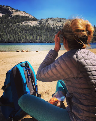
Near White Wolf, we stopped at a lovely little lake before driving on to Olmsted Point. It was very windy at this location but it had an amazing view of Half Dome from the backside of Yosemite Valley. More prominent is Cloud's Rest, whose granite north face rises 5,000 feet over Tenaya Creak for a total elevation of 9,926 feet. Scattered all around Olmsted Point are boulders called Glacier Erratics left behind when the ice melted thousands of years ago. We reached the mile long Tenaya Lake at 3pm where we relaxed in the sun on the sandy beach and ate lunch. The freezing waters of this alpine lake were crystal clear.
When we reached Tuolumne Meadows, we parked on the west end and took the trail out to Pothole Dome sitting like an isolated island in the middle of a yellow ocean. Climbing the gently sloping dome, it was cool to see where the granite surface had been polished smooth by ancient glaciers. I find it amazing that trees are able to grow in the cracks on these domes. I kept climbing higher and higher, always finding a another peak further back. Near the top, we 360 degree views of the area. I expected to see more people around but we had the dome all to ourselves.
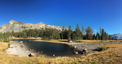
Continuing on past Tuolumne Meadows, we arrived at the Tioga Pass Entrance to the park at 5pm. It was freezing and super windy there so I quickly explored the small lake in Dana Meadows nearby. From there, I could spot Mount Dana, which marks the eastern border of the park and is the second highest mountain in Yosemite at 13,061 feet. Driving back took much less time since we only made one quick stop at Olmsted Point for the view at sunset. Arriving in Yosemite Valley after dark, we went for pizza in Half Dome Village. There was a long line, but they made them fast and we had our food within fifteen minutes. It hit the spot after another long day of exploring.
First thing Tuesday morning, we hiked the short trail up under El Capitan. It was awe-inspiring looking straight up the Nose of the 3,000 foot granite face. This big wall is twice the height of the Empire State Building. There were a couple of climbing teams directly overhead. The best way we found to watch their progress was to lie down on a nearby log, otherwise we quickly got a kink in our neck from staring up. Before we left, both of us climbed a few feet up the face just to say we did. (Even that was tough!) We definitely need to take a rock climbing class the next time we come to Yosemite.
Leaving El Capitan, we took one of the free shuttle buses for the first time to reach the Mist Trail. On the way, we passed the prescribed burn in Ahwahnee Meadow. Smoke rose from the surrounding trees as firefighters set small fires to clear out the underbrush and minimize larger wildfires in the future. Upon arriving, we explored the short trails at Happy Isles to the small islands in the Merced River and into the nearby fen created by rockfalls from Glacier Point before we began the ascent of Mist Trail.
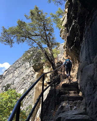
While our legs were still sore from the 4 Mile Trail on Sunday, it was the steep climb's effect on our lungs that we felt the most as we worked our way up the steep path to the first footbridge where we took a short snack break and caught our breath. As we neared the base of the first falls, the trail became more of a staircase as the sound of crashing water filled our ears. Since it was late summer, the Merced River was a thin ribbon instead of a thick curtain as it flowed over the Vernal Falls but it was still impressive as we crossed over the rocks to the pool underneath. To reach the top of the falls, we had to navigate a narrow staircase cut into the canyon wall. After standing at the railing to look straight down the 317 foot waterfall, we ate lunch while attempting to shoo away the colony of begging squirrels. Those guys were not shy at all as they climbed on our shoes and investigated our backpacks.
Above the Vernal Fall is the tranquil looking Emerald Pool but it is dangerous to swim in as undercurrents have been known to sweep people over the falls when the water lever is high. A little farther up the trail, Tori and I encountered the Silver Apron, a smooth granite slope where the water cascades down in a thin sheet. While dangerous during high water, many lesser injuries occur here when the water is low due to sunbathers using the slippery slope as a water slide and crashing into rocks below.
Tori stayed behind at the Silver Apron while I hiked the short distance to the second footbridge. From there, I had a good view of the Liberty Cap granite dome and the Nevada Falls below it. I had the strength to continue the hike up the falls, but I turned around here due to my bad knee. While it feels great going uphill, walking down steep trails is pretty painful after a while. Below the first footbridge, I walked half of the way down backwards.
After reaching the valley floor, we took the shuttle bus to the Ahwahnee Hotel to relax at the bar with drinks and appetizers. On our way out of Yosemite Valley for the last time, we stopped at the Valley View at sunset. The viewpoint closely resembles the landscape from Tunnel View except that it is from a lower elevation with the Merced River in the foreground. The river was low and peaceful but nearby was a Flood Level Sign showing the height of the flooded river during the El Nino Winter of 1997. Tomorrow morning, we are driving south to visit the Sequoia and Kings Canyon National Parks.
Link to my next post at Kings Canyon National Park.
Link to my next post at Sequoia National Park.


No comments:
Post a Comment